In years past I’ve gone to Silverfork off highway 50 for Memorial Day weekend. That was back when I was younger and didn’t care about sitting in stop-and-go traffic for 8 hours to get home. These days I’m much more likely to stay home on holiday weekends. But Sonora Pass called to me…
Sonora Pass is the second highest highway overpass in the Sierra Nevada. It’s also the last one on my list. Yum and I have traversed highways 120 4 88 50 80 70 and now 108. More red ink for our map of California! (we have a map on our wall at home with red ink tracing all the major roads we’ve traveled together)
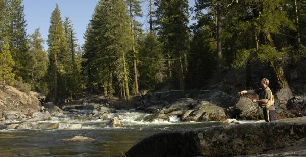
First we stopped at Kennedy Meadow Resort. It’s a nice little place tucked away in a corner not far from the main road. There is a general store, a restaurant, a bar and many cabins and campsites by the river. About 15 minutes walk up the trail and over the hill is the huge meadow. The river flows alongside the meadow, and looks to be PERFECT for fly fishing. The water was a little high this trip, but in about four weeks it should be JUST RIGHT! I’ll be back.
Yum and I explored this area for a few hours and then continued our journey up highway 108, ever closer to Sonora Pass. Lightning arced across the sky and thunder BOOMED and echoed across the canyons and mountaintops. It began to rain pretty hard. The road became narrower and windier, and the rain turned to snow. Snow! This close to June? Yes.
It’s always amazing to me how unique and distinguishable the environment changes as I drive one of these highway overpasses. In the central valley it’s flat and hot and you mostly just see weeds and cows and farms. As you get close to the foothills of the Sierras the terrain becomes rocky and flat plateaus scatter the landscape among the plentiful oak trees and black volcanic rocks. As you climb higher you begin to see more pine trees and less oak trees. At around 5,000 feet it’s almost all pine trees and the weeds are long gone. At about 8,000 feet the trees are starting to thin out a bit and that beautiful high Sierra granite can be blinding in places. Above 8,000 feet is my favorite part of the mountains–up here it’s quieter and there are less people and the scenery is the most spectacular. On the way down the eastern side of the Sierras–no matter where it is, it’s extremely steep and jagged–there is a noticeable absence of trees and vegetation in general. As it flattens out again I’m in the high desert, and it’s hot and dry and dusty and… desert-y. And that’s pretty much how each highway goes, from west to east. And I love every inch of it.
So then. Once in the eastern Sierras Yum and I turned north on highway 395. After a quick detour on highway 89 we reached highway 50, where we drove down to Placerville and stopped at the Red Hawk Casino. Yum found $20 on the ground and was so excited she peed her pants. OK, not really. But she was super excited. She’s so cute! I love that little Yum =)
And then we went home.

